

Why Land Surveying Is Important Before Construction in the UAE
Before you begin building, there are a few things you should know about the land you choose.
In what exact place do the land lines meet?
Is the ground at different heights?
Is there a road, building, drainage system, or other structures already on the land? These little details might not seem important, but they can make a huge difference to a building project.
So, land measuring services in the UAE are an important part of planning to build something. After a good land survey, architects, engineers, and contractors can get correct information about the location before they start building.
A land survey is basically an in-depth map of a piece of land.
An experienced land surveyor comes to the site and makes notes of important details like the location, the look of the edges, the height of the ground, existing features, etc. Some of the tools that UAE land measuring services use these days include GPS, GNSS, total stations, drones, and 3D laser scanners. The results of the survey can be used for planning, designing, building, and setting up the site after the survey is done.
It may look easy and flat when you get there, but the ground may not be what you think it is.
The slopes, heights, roads, walls, drainage features, or other parts of the land might change in small ways.
A land study helps you find these things before you build.
This helps the project team plan their work and enhances the look and feel of the site.
There should be no doubt about where the land lines are before any work starts.
A land surveying firm in the UAE can take the measurements you need to find the boundaries of the site and record them. This helps the project team ensure the building and other things on the site do not go over the lines.
Different areas of a site may have different ground elevations.
Even small changes in elevation can affect things like digging, building foundations, roads, drains, parking lots, and the general grade of the site. The topographical study of the UAE gives you information about the land's levels, shapes, slopes, and other features. If engineers know this, they can see what is already there before they start planning the job. It helps engineers and architects learn more.
For example, they need to know:
A full poll gives them this information in a way that is clear and useful.
It would be bad to start working on the base and then find that the ground level isn't where it should be.
Or, picture finding out that a feature that was already there wasn't where it was supposed to be based on the plans.
Things can change, take longer, cost more, and be delayed when things go wrong like this.
You can get accurate numbers that the project team can use right away if you hire a land surveyor before you start building.
A lot more work goes into land surveys these days because of technology.
Surveyors can quickly gather a lot of useful information that can be used for any job, no matter how big or small.
A lot of people use GPS and GNSS devices to find their exact location and coordinates.
GPS land surveying can help with building sites, infrastructure projects, land development, roads, and other things in the UAE.
With a total station, you can find angles and lengths with great accuracy.
They let you look at the spot, plan the building, set up checkpoints, and make sure everything is level and in the right place.
It can take a long time to survey large sites the old-fashioned way.
A drone can fly over a large area and take pictures. It is also used to create detailed maps and to collect data for surveys. Drone land surveying is useful in the UAE for big construction sites, infrastructure projects, excavation, mines, and land expansion. Create 3D Laser Scan: 3D laser scanning is useful for knowing a lot of details about an existing building or location. You can generate a 3D point cloud from the data and use it for creating plans, measuring things, and monitoring things. 3D land surveying can be useful in the UAE for projects that require knowing a lot of things about the land.
A topographical survey is a survey of the shape and features of the land. It can show things such as how high the ground is, slopes, shapes of buildings and roads, walls, drains, and other parts of the building that can be seen. In the UAE, topographical surveys are often done before land is built on, roads are made, and other infrastructure work is done. In simple terms, a geographic study helps us answer a big question: “What does the site look like, with all of its levels and features?”
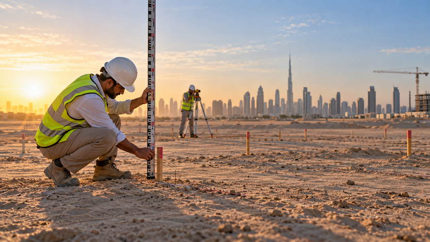
Land plans are useful for more than just building. They can help with lots of jobs. Before the plan: The survey tells us how the place is now and helps us plan. Before the building started, surveyors can mark out levels, points of interest, and positions when they first start. During construction, surveying is used to make sure that the work is at the right height and in the right position. After Construction: A scan of the work “as-built” can show where it is and what it looks like today.
This means that measuring is useful at every stage of the project, not just at the beginning.
A good survey is important for almost any job that builds something or changes the land.
These are some of them:
It will depend on the project, the site, and the data that is needed on what kind of survey is needed.
Why is it important to hire the right survey team? Because the quality of the survey data can affect later stages of the project.
If you are looking for a land surveying company in the UAE, you should consider their experience, the tools they use, level of expertise, and ability to provide you with clear and useful survey data. Some of the tools that you can expect a professional survey team to use are total stations, drones, digital levels, 3D laser scanners, GPS, and survey-specific software. Depending on the size, location, and requirements of a job, the optimum technology to use will vary.
Before you can successfully plan a building project, you need to know where you're going.
Before you start building or making plans for a piece of land, a land survey will tell you everything you need to know. It helps you to find the boundaries of the property, the elevation, any slopes, existing features, and other vital information. State-of-the-art tools like GPS and GNSS, total stations, drones, and 3D laser scanning are all used for land surveying in the UAE for a variety of projects. Building a home, a business, a road, an infrastructure project, or even a large tract of land can be very useful if you have accurate data about the site from the very beginning. Know the land before you begin building.