Our 3D planning services at Falcon 3D Middle East make it easier for you to see, understand, and plan where things are in the real world. To make accurate and thorough 3D digital models of real-world places, we use the newest scanning, drone, and mobile mapping tools.
We have 3D tools that can help you make faster and better choices, no matter what size project you have or whether it's inside or outside.
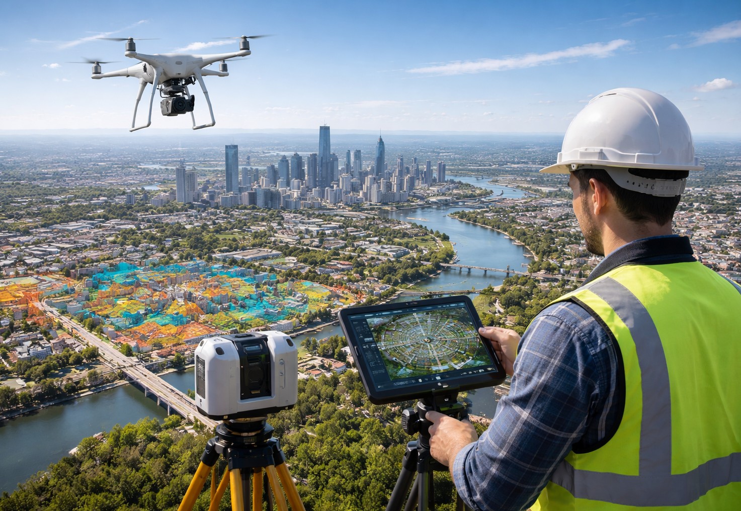
Taking pictures of real places and making them into realistic 3D models is what 3D mapping is all about. You can see what houses, land, roads, and buildings look like much better in these models than in 2D images.
You can use our 3D mapping service to get accurate models that you can use for planning, creating, and analyzing. We write down everything so you can see things clearly and avoid making mistakes that cost a lot of money.
The information is correct, and the 3D pictures are very easy to see. It works for jobs of any size.
By using 3D projection mapping, we can make structures and houses look great. Great locations to use this service are trade shows, events, product releases, and company activations.
How it works:
We offer 3D scanning drone services that make it easy and safe to get information from the sky. We get accurate 3D models by using cutting-edge drone technology to take detailed pictures and measures.
Perfect for:
Large areas, like roads, highways, and infrastructure routes, are what the 3D mobile mapping service is made for. While moving, our vehicle-based systems receive accurate data, which saves time and keeps the work site from being interrupted.
Important pros:
Some important perks are:
Quality, clarity, and clear communication are important to us, so you always know what you're getting.
There is a reliable 3D mapping service in Dubai called Falcon 3D Middle East that can help you. Get in touch with us right away to find out how 3D mapping can help your project. Get in touch with us right away to set up a free consultation.
Contact Us