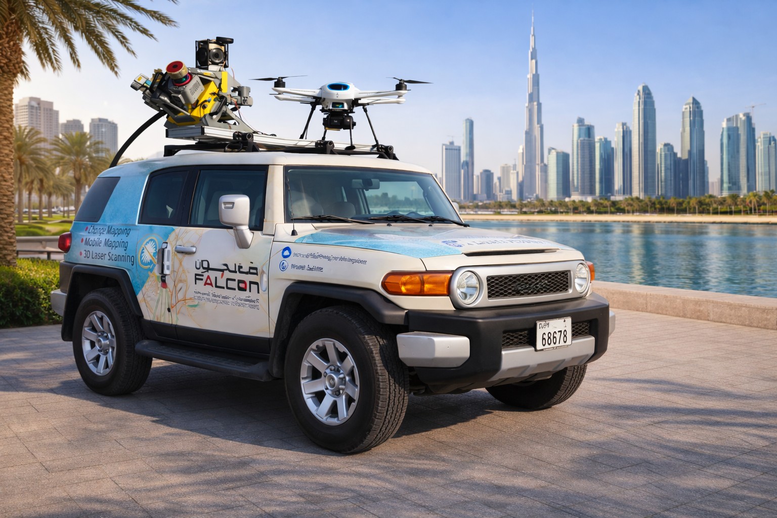
Falcon Survey Engineering Consultants is a pioneering Survey Engineering Company in UAE established in the year of 2007, built on a strong work ethic, honesty and a commitment to relationships. Today Falcon is one of the leading organizations in the field of Land Surveying, Survey Engineering Companies, Soil Investigation, Ariel Survey (UAV/Drone Mapping), Bathymetric Survey (Hydrographic), Underground Surveying, 3D Laser Scanning Surveying, Calibration Services, Material Testing as well as Geographic Surveys which has International Standard and Quality. We have achieved a solid reputation for providing conscientious and reliable engineering survey solutions to a wide range of infrastructure, construction and development projects for International Clients, Government Sectors, Consultants & Constructions Companies in U.A.E. With more than 12 years of experience, Falcon continues to improve its heritage by strengthening its dedication & sincerity to each & everyone.
We use sufficient quantity of the latest surveying equipment like Leica P40 Scanner Station, Dimension Control Industrial Total Station SOKKIA SET 05AX II, GPS (Trimble R10, Leica VIVA 15, &Sokkia etc.), Underground Scanning GPR Equipment like GSSI Dual Frequency, RD1000 Plus, RD8000, Total Station (Leica, Topcon, Trimble, Nikon etc.), Auto level machine, computers, laptops, drafting/plotting instruments, vehicles etc,for projects like Infra Structure Developments, Major Roads & Bridges, High Rise Towers in UAE and other Middle East Countries as a consultant and contractor for surveying
Over 12 years of industry experience delivering excellence in surveying and drone solutions.
Serving over 900 satisfied clients across diverse industries with precision and trust.
Successfully delivering over 10,000 projects with accuracy, innovation, and dedication.
Backed by a strong team of over 300 skilled technical professionals ensuring quality service.
At Falcon 3D, our mission and vision guide everything we do — from how we serve our clients to how we shape the future of surveying and engineering across the UAE.
Gain accurate insights from above with drone-based aerial inspections. Our high-resolution imagery and data capture help detect issues early, ensure safety, and improve project efficiency.
Delivering precise ground and aerial surveys using advanced equipment and techniques. We provide accurate topographic and geospatial data to support design, construction, and infrastructure planning.
Capture every detail with high-accuracy 3D laser scanning. Our scans provide reliable as-built data for faster design, reduced errors, and smarter decision-making.
Monitoring & Inspection means regularly observing and checking systems, equipment, or environments to detect issues early, ensure safety, maintain quality, and confirm everything works as expected.
Whether it's a complex infrastructure survey or precise 3D laser scanning, we deliver accuracy, innovation, and efficiency. Let's discuss how we can bring your vision to life.
