Home About Us
All Services Drone Surveying Services Land Surveying Services 3D Laser Scanning Mobile Mapping Services Bathymetric Survey Monitoring and Inspections Concrete Scanning Pipeline Inspection Underground Utility Survey BIM Modeling
Blogs Industries Portfolio Contact Us
Get a Free Quote
+97143271414 info@falconsurveyme.com
Back

Fast. Accurate. Drive-Through 3D Mapping

Vehicle Based Mobile Mapping Services for Architecture, Engineering, & Construction

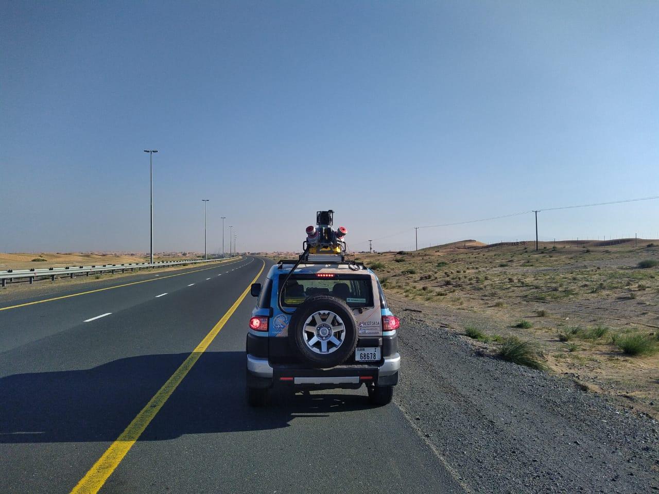
Vehicle-based Mobile Mapping services from Falcon3D collect a lot of 3D data as you drive through an area. There shouldn't be any traffic delays. The page doesn't have a lot of long work. I only need solutions that are quick and right.

By collecting high-quality 3D Mobile Mapping data for roads, cities, and infrastructure, our smart mapping cars make a lot of studies faster and easier.

Covering long roads, highways, and busy places with this method won't get in the way of normal business.

What is Vehicle Based Mobile Mapping?

Basically, 3D mapping was done while the car was moving. A vehicle has high-tech scanners, cameras, and GPS systems attached to it. The system makes a detailed 3D map of everything around it as it goes, including roads, buildings, signs, utilities, and more.

Vehicle Based Mobile Mapping

Why Use Vehicle-Based Mobile Mapping?

  • Much Faster : It takes hours, not days, to map out large places.
  • No Traffic Disruption : No need to close roads to collect data. it's done while moving.
  • Highly Accurate : It gives you accurate 3D info that is linked to a location.
  • Safer for Teams : Because people are on-site less, everyone is safer. Our Vehicle Mapping Solutions
  • 3D Mobile Mapping : Making 3D point clouds that are clear and full of information makes it easy to measure and analyze.
  • 3D Mobile Mapping for Autonomous Vehicles : Testing, navigation, and simulation of self-driving cars using real-world 3D settings are all possible with our data.
  • Road & Highway Mapping : Quickly record road layouts, marks, signs, and things that are available on the side of the road.
  • City & Infrastructure Mapping : This tool is great for smart city projects, urban planning, and managing assets. Where This Service is Commonly Used?. These situations work well with our vehicle mapping solutions.
  • Smart city projects, Transportation planning, utility and infrastructure studies, Self-driving car development, Digital twin and 3D city models are just a few of the things that we work on.

What makes Falcon3D better?

People who work with cars and have done a lot of 3D scanning have made mobile mapping tools that work now.

A lot of activities can be done in a short amount of time.

Quick and easy to use outputs for GIS, CAD, and BIM. What's important to us are real results, clear facts, and simple steps.

Get Smarter with Maps

Looking for dependable 3D or road mapping services for your phone in the UAE? Falcon3D is ready to help.

Call us right now, and we'll help you make a good plan for your job.