It doesn't have to be hard or take a long time to get the correct site information. Aerial drone mapping lets you get a clear view of your whole spot from above and get accurate information faster. Businesses can plan better, work faster, and avoid mistakes that cost a lot of money with our Aerial Mapping Services in Dubai.
We use high-tech drones and skilled workers to get clear pictures that we then turn into maps and models that are easy to understand.
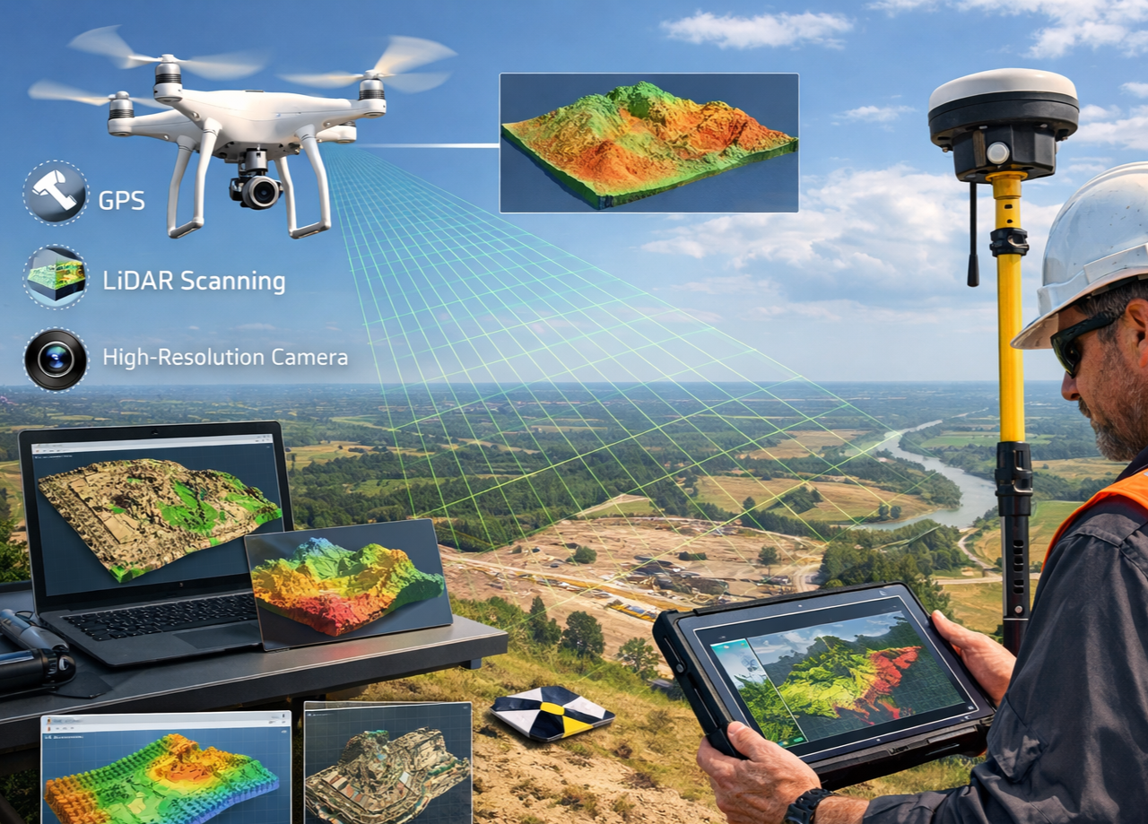
Aerial drone mapping is when you use drones to capture pictures of your place from the sky. After that, these pictures are put together to make:
It lets you see your project area clearly without having to spend a lot of time surveying or using heavy equipment.
You can see the whole project area with our Mapping Drone Solutions in Dubai, even in places that are hard to get to on foot. UAVs fly over the spot and collect accurate data without getting in the way of work that is already going on. In other words:
When making important project choices, it's important to be right. Our Accurate Aerial Mapping Services in Dubai give you accurate readings and easy-to-understand pictures that help you stay on track. We give you:
All the information is carefully checked to make sure it meets the standards of the trade and the area.
We use the best drone in Dubai for surveying and mapping. It is made to work in rough situations and over large areas. Drones with high-resolution cameras and clever tracking systems always get clear and correct results.
Our staff chooses the best drone for your job to guarantee maximum success. A lot of different companies use drones for mapping and surveying, Numerous areas can benefit from our Drone Mapping and Surveying services, including
Evaluations of the environment Drone maps give you correct information and clear ideas for any job, no matter how big or small it is.
Begin your project to map the sky with a drone today.
We're ready to help. We make sure the whole process goes smoothly, from planning the spot to writing the final reports. Get in touch with us right away to talk about your project and find out how aerial drone mapping can help.
Request a Drone Mapping