Home About Us
All Services Drone Surveying Services Land Surveying Services 3D Laser Scanning Mobile Mapping Services Bathymetric Survey Monitoring and Inspections Concrete Scanning Pipeline Inspection Underground Utility Survey BIM Modeling
Blogs Industries Portfolio Contact Us
Get a Free Quote
+97143271414 info@falconsurveyme.com
Back

Metocean & ADCP Current Monitoring

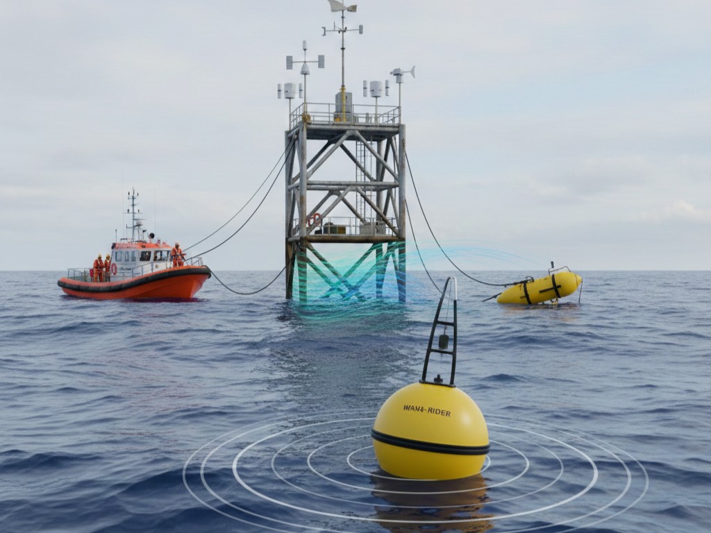
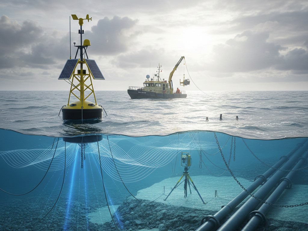
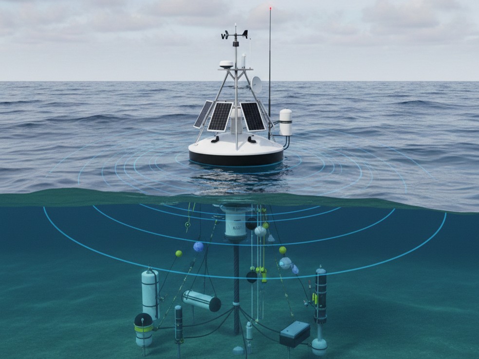
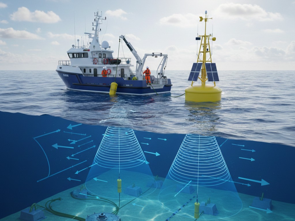
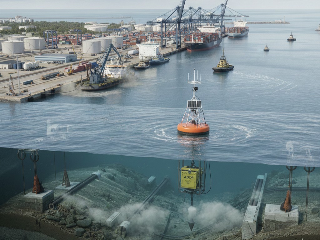
Falcon 3D Middle East can help you learn about the marine area so that your tasks go smoothly and safely. We can tell you the truth about tides, waves, and water currents through our Metocean monitoring and ADCP current studies. It helps you be sure of the decisions you make for tasks at sea, on the shore, or in a port

Why it's important

The ocean is always moving. Trends change, surges rise and fall, and seas rise and fall. Your project might take longer, cost more, or be dangerous if you don't have it all together.

We can use our Acoustic Doppler Current Profiler (ADCP) to find out how water moves at different levels. Because it shows you how forces work at your place, you can plan better, make better things, and stay safe.

Drone Inspection

Everyday applications

Many types of projects can use our tracking services. For example,

  • when building things on land or in the water, we can make sure they can handle surges and waves.
  • For ports and harbors, organized dredging, land reclamation, and safe passage are all important.
  • Coastal and environmental studies look at how water and silt move.
  • Pipelines, moorings, and sites that are submerged in water are all types of marine infrastructure.
  • Vessel operations help ships and equipment work well.

Our monitoring gives you the information you need if your project has to do with water.

How We Keep an Eye on Things

We make it easy and dependable to keep an eye on things:

  • Plan and Assess: We look at your project and site to figure out what you need.
  • Deploy Equipment: We use bottom-mounted, vessel-mounted, or buoy ADCPs to collect data where it matters.
  • Collect Data: We keep track of waves, tides, and currents all the time and with great accuracy.
  • Analyse and Interpret: We make sense of raw data and turn it into useful information.
  • Report and Recommend: You get reports that are easy to understand and advice on how to make decisions with confidence.

What You'll Get

We don't just provide you with statistics. We give you data that you can use:

  • Current profiles from the seafloor to the surface
  • Data about currents, tides, and waves throughout time
  • Basic graphs and charts that show things visually
  • Suggestions for how to design or run things
  • Unprocessed data for modelling or more study

Control and Quality

Our number one goal is accuracy. We do thorough quality checks on every survey we do so that you can trust the results. The information we have is:

  • Dependable and accurate
  • The same all around the site
  • Easy to read and understand
  • On time and ready to make a decision

Why should you pick Falcon 3D Middle East?

We have years of experience and cutting-edge technology. We have the trust of our clientele because we:

  • Make hard-to-understand marine data easy to understand
  • Give information that helps projects go smoothly
  • Make surveys that fit the needs of your project
  • Provide results you can trust and rely on. Support projects all around the UAE and in nearby waters

Plan Better, Build Smarter

Metocean monitoring and ADCP current surveys from Falcon 3D Middle East give you the information you need to lower risk, save time, and make your maritime projects a success. Please get in touch with us today to find out how we can help with your project.

Contact Us

Frequently Asked Questions

Meteocean monitoring checks things like currents, tides, and waves in the ocean to make sure that marine projects are safe and work well.

An ADCP uses sound waves to measure the speed and direction of water currents at different depths.

These surveys give us accurate, up-to-date information that helps us build marine structures, plan dredging, and make sure that ships can operate safely.

These are often used for building offshore, in ports and harbors, for coastal studies, for pipelines, moorings, and for boat navigation.

Clients get profiles of currents and waves over time, as well as charts, reports with suggestions, and raw data for models.

We give you MetOcean monitoring and ADCP survey data that is correct, reliable, and usable for your project.