

Know what's below you before you build at Sea.
It's exciting to plan a project in another country, but there are hidden problems.
On the surface, the water may look calm, but there could be an uneven seabed, old cables, buried pipelines, rock formations, soft sediments, or even boat wrecks below. If you don't find these hidden problems until after construction has begun, they can quickly become expensive issues.
This is the reason why skilled builders and contractors never start an offshore job without first doing a Marine Geophysical Survey.
When you know exactly what's under the seabed, you can plan your project correctly from the start, whether you're building a jetty, expanding a port, dredging a channel, laying underwater pipes, or building coastal infrastructure.
Falcon 3D provides quality, reliable, and professional Marine Geophysical Survey solutions to help companies across the UAE better understand what is happening underneath the water.
It would be silly to try to build a house without first seeing how the land is.
Sure sounds risky, does it not?
When building offshore, the same rule applies.
In a way, a Marine Geophysical Survey is like looking into the bottom. Experts use the latest in marine survey technology to collect very detailed information on what's on and under the seabed. The survey finds things like rock formations, hidden utilities, sediment layers, and underwater features that could affect your project.
If you have good information, you don't have to make decisions based on guesses.
Putting up a building offshore costs a lot of money, and shocks can cost a lot, too.
Imagine that halfway through the project, your construction crew finds an old pipeline or an unstable seabed. Engineers may have to stop work while they rethink the project or come up with another way to do it.
This implies:
A Marine Geophysical Survey can help you avoid these problems by showing you possible issues before the building starts.
A small step taken during planning can save a lot of time, money, and stress in the long run.
A lot of people think marine studies are just about avoiding dangers.
Actually, they improve every aspect of your project.
As engineers understand more about the seabed, they can design buildings that are safer, stronger, and more suitable for the site.
Good survey data guarantees that project teams can properly position foundations, pipes, cables and offshore structures.
It's cheaper to catch problems before they happen than to correct them once the work has started.
Often delays are caused by discoveries that were not planned.
When you have a Marine Geophysical Survey, no one has to worry about projects going beyond schedule.
As long as everyone involved in a project has access to accurate information, everyone can make smarter choices and lower the risks of the project.
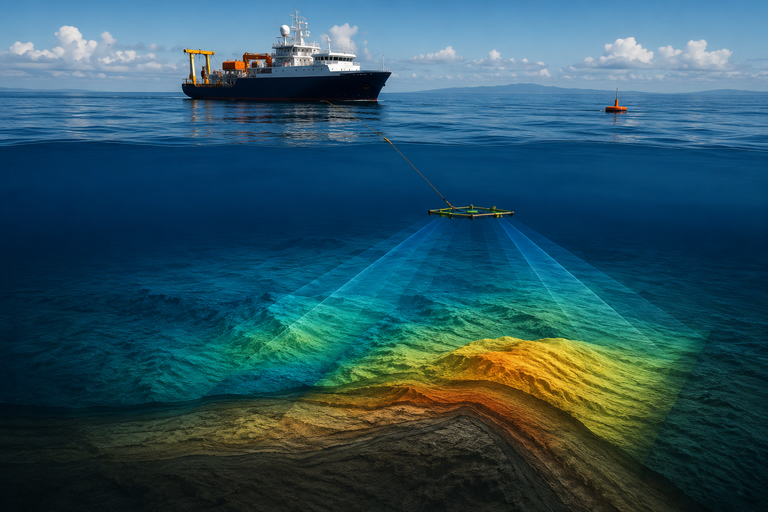
Ocean geophysical surveys today use a number of cutting-edge tools to get a clear picture of what's going on below the surface.
Side-Scan Sound System: This system makes clear pictures of the ocean floor that help you find things like rocks, debris, shipwrecks, pipes, and more that are underwater.
The profiler is at the bottom.
It determines the nature of the sediment, the features below the surface, and what is below the surface that is too deep to see from the surface.
When you put metal objects like pipes, anchors, cables, and other tools underground, the Magnetometer for the Sea can find them.
Helps engineers understand what is happening underground by providing very detailed maps of the seabed and telling them how deep the water is.
When these technologies are combined, we can be sure that the plans we make for projects that will be implemented abroad are correct.
Marine geophysical surveys are useful for a lot of different projects that need to be done in or near water.
These are some common uses:
For projects that need to know about the bottom, a Marine Geophysical Survey is the first thing that needs to be done.
Picking the correct survey company is just as important as picking the correct builder.
Falcon 3D uses both skilled professionals and cutting-edge marine survey technology to give you reliable results.
Customers believe in us because we provide:
We give you more than just survey results; we give you the information you need to make smart choices and keep your project moving forward.
Every offshore job starts with a plan. But to make that idea a reality, you need more than good planning. You need the correct information.
A Marine Geophysical Survey shows you what is clearly under the water. This helps you find risks, make designs better, protect your investment, and avoid costly surprises.
Getting a professional Marine Geophysical Survey is one of the best things you can do if you want to build something new in the water, install infrastructure underwater, or make a current facility bigger.
Falcon 3D wants to help our clients build offshore projects that are better, smarter, and more successful.
Because knowing what's below the surface is the first step to any successful offshore job.
It is a safe and effective means of preparing for offshore projects by providing information on the characteristics of the bottom, below-ground features, and possible risks.
Where feasible, before any development, dredging, pipeline installation, or coastal growth begins.
“Yeah. Early detection saves delays, redesigns, equipment failure, and building costs.
Marine construction covers offshore oil and gas, ports, dredging, renewable energy, coastal engineering, environmental projects, and underwater infrastructure.
Falcon 3D provides accurate maritime survey data, professional expertise, innovative technology, and reliable offshore solutions in the UAE.