

You need to know about the sea before you build in it.
When you plan a job that will be done offshore, there are some unique challenges that you have to deal with.
The sea is always changing, unlike building on land. The weather can change quickly, ocean currents can change throughout the day, tides rise and fall, and waves get bigger.
These changes can be minor but can significantly change your concept. They can delay construction, reduce the efficiency of equipment, increase expenses, and jeopardize the safety of all personnel involved in offshore operations.
So, how do marine projects that go well avoid these problems?
The answer is easy: they start with correct information about the ocean.
That's where ADCP Current Monitoring and Ocean Surveys come in. Before work begins, these services help engineers, experts, and contractors know exactly what's going on in and around the water, making it easier to plan every step of the project with confidence.
Reliable marine data helps you make better decisions from the start, whether you're building a port, dredging a navigation channel, putting in a subsea pipeline, or improving infrastructure along the coast.
An Ocean Survey is like getting a full picture of the sea before you start working.
Engineers don't just guess about the weather and ocean conditions at the project site; they get real information.
Among these are:
This helps project teams know what to expect on the job site so they can plan their work better.
Figuring out how water moves below the surface is one of the hardest things to do offshore.
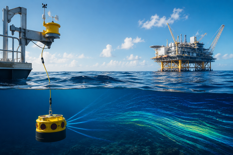
Acoustic Doppler Current Profiler (ADCP) is a special tool that finds the speed and direction of water currents at different depths.
It doesn't just give you information from one place; it makes a detailed profile of how water moves through the whole water column.
This helps engineers understand the effect of currents on construction projects, ships, underwater sites, and the performance of structures over time.
Imagine putting in a pipeline underwater without knowing how strong the current is.
Or getting big things off of a boat while the tide is quickly changing.
These things can raise the risk, cause work to be delayed, and cost more than it needs to.
Accurate Metocean and ADCP data give project teams confidence in their planning, knowing what to expect before work starts.
Safety first always when you work offshore.
Real-time tidal, wave, current, and weather information allows teams to schedule work for safer times. This reduces threats to workers, boats, and equipment.
No project manager wants to stop work because the weather at sea is changing.
If teams are aware of the marine environment ahead of time, they can choose the best time to do activities offshore. This helps projects stay on schedule and on budget.
Every marine structure needs to be made to last for years in the conditions it will be used in.
Correct Metocean data helps engineers make designs that are better and more reliable.
Designs that are better because of better data.
A lot of projects that are done abroad need environmental approvals before they can start.
Monitoring the oceans helps figure out what's going on with the water, how it affects the environment, and how to follow local rules, which makes projects last longer.
Offshore troubles that come up out of the blue cost a lot.
Marine data that you can trust can help you plan better, avoid needless downtime, and stop mistakes that cost a lot of money before they happen.
Putting money into correct surveys at the start of a project can save a lot of time and money later on.
Surveys of the ocean floor and monitoring of ADCP currents are used for many marine and coastal projects, such as
For marine projects, you need more than just high-tech tools. You also need to know a lot about the marine environment and have a lot of experience working with it.
We at Falcon 3D Middle East offer professional Metocean Surveys and ADCP Current Monitoring services that help our clients make smart choices at every stage of their project.
We offer the UAE reliable environmental data, comprehensive technical reports, and helpful insights to make operations safer, planning more efficient, and projects successful, all achieved through the use of state-of-the-art marine survey technology and skilled professionals.
No matter how the sea is changing all the time, you should not allow this to happen to your project.
By knowing the sea conditions prior to construction, it is easier to make safe, informed, cost-effective judgments.
Metocean Surveys and ADCP Current Monitoring provide the reliable data you need to proceed with your plans, whether for a small coastal development or a large offshore infrastructure project.
Partner with Falcon 3D Middle East for Accurate Metocean Surveys and ADCP Current Monitoring services in the UAE. We can provide you with the right marine data you need to make your job safer, reduce your risk, and keep you on course from start to finish.
A lot of projects that are done abroad need environmental approval before they can start.
Monitoring the oceans helps figure out what's going on with the water, how it affects the environment, and how to follow local rules, which makes projects last longer.