free html5 templates

Road Crossing Level Monitoring

Monitor the road surface level before and after the micro tunneling by using Leica P40 3D Laser Scanner Station in order to analyze the effect of the tunneling works.

Asphalt Level Monitoring

Road Crossing Level Monitoring using 3D Laser Scanning Services (HDD / NDRC)

Monitor the road surface level before (pre drive) and after (post drive) the micro tunneling by using Leica P40 3D Laser Scanner Station in order to analyze the effect of the tunneling works.

The Leica Scan Station P40 deliver highest quality 3D data and HDR imaging at an extremely fast scan rate of 1 mio points per second at ranges of up to 270 m. Unsurpassed range and angular accuracy paired with low range noise and surveygrade dual-axis compensation form the foundation for highly detailed 3D colour point clouds mapped in realistic clarity. 

3D laser scanning has seen use for an array of applications since its inception. Some of these are visually impressive if not stunning, using laser scanning technology to scan roadway and highway surfaces is rather bland. But the virtues of the technology manifest themselves in many ways, including improved project cost performance, schedule reductions, deliverable quality, and safety. The design, construction, and maintenance of roads and highways require accurate drawings and maps, edge of travel way, pavement markings, crown lines, curbs, sidewalks, gutters, vegetation, signage, utilities, pavement depressions, cross slopes, and surrounding terrain. 3d laser scanning is ideal for capturing these types of features 

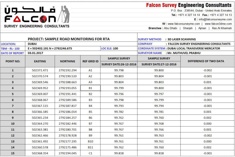
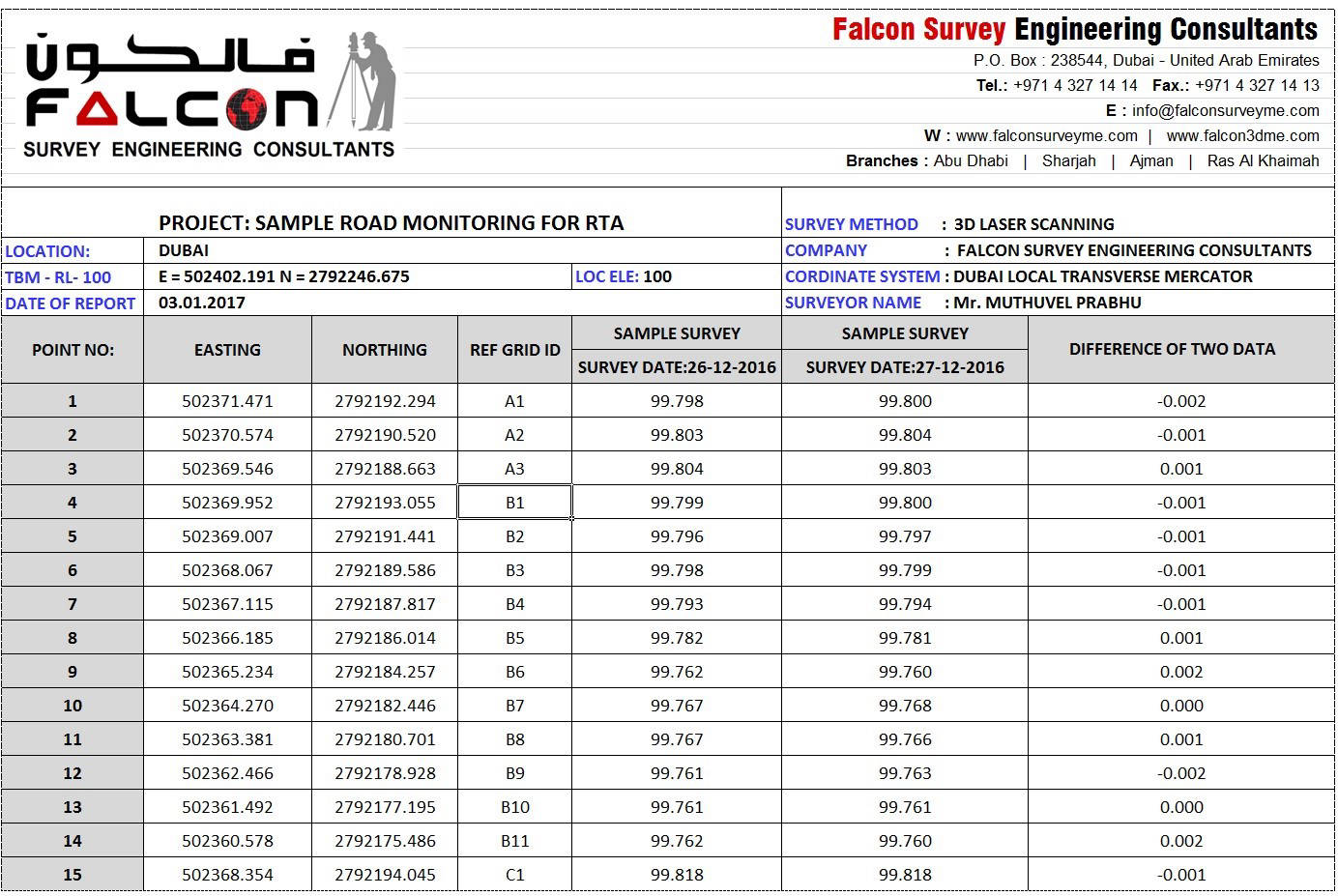
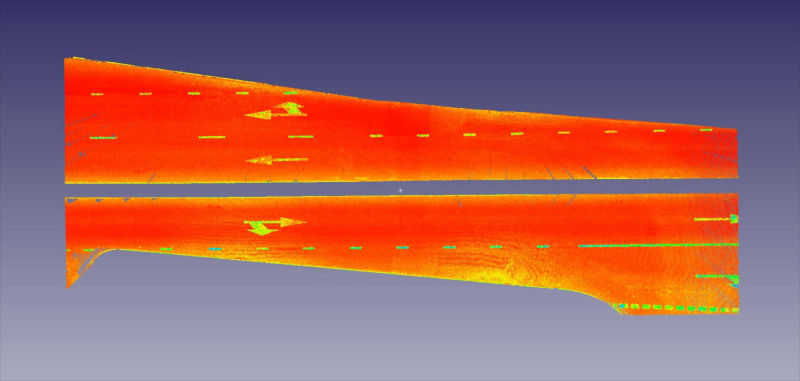
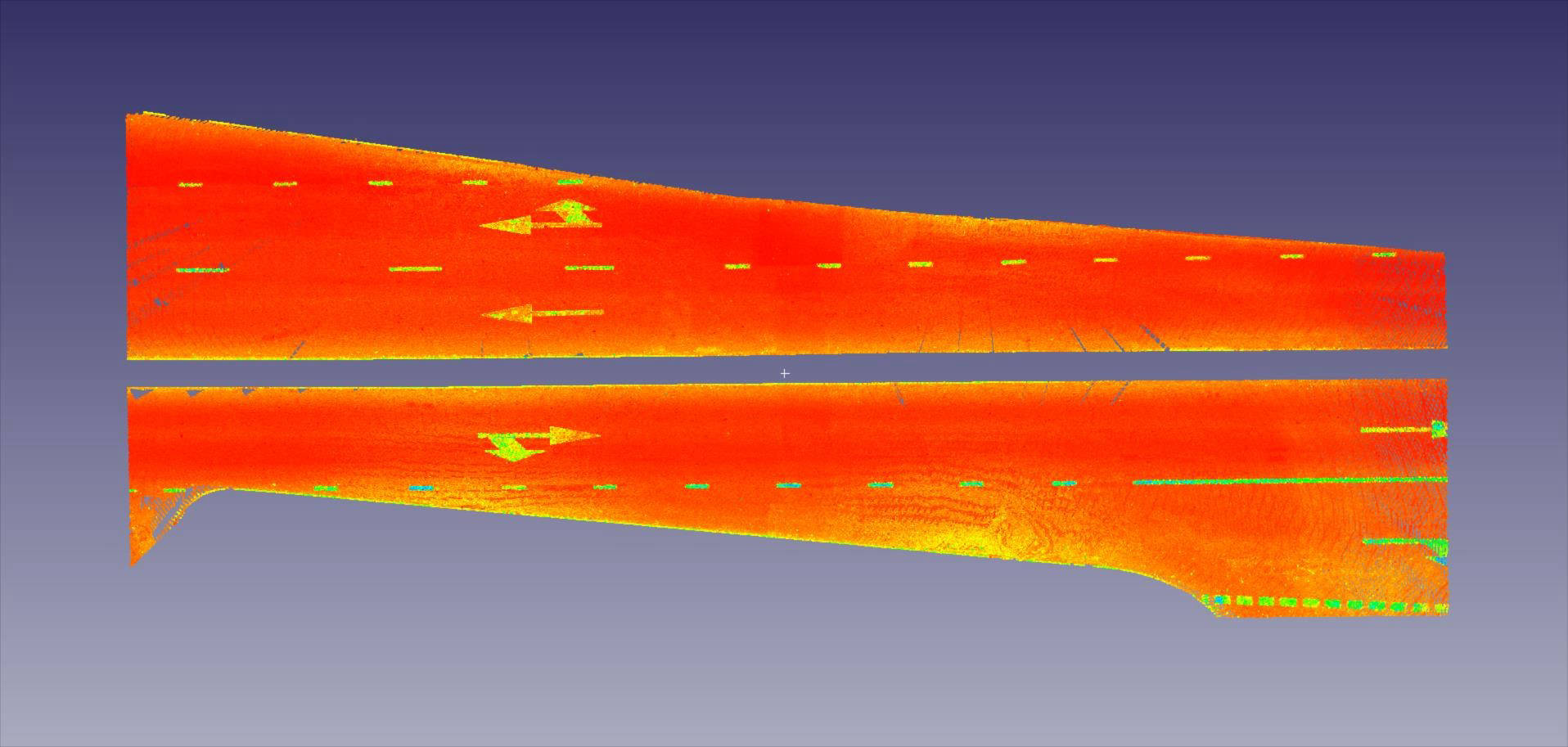
The above picture illustrates the model of a Scanning and this is very secure method of road level scanning without interrupting the Traffic and no need to worry about any Risk from Road Accidents. If you required pre and post drive scanning for the Micro-Tunnelling Works, we can do it using the Method of Laser Scanning and this is an approved technology of Road Level Monitoring by the Authorities. The below image indicates an Excel sheet prepared based on the Scanning Works done on different Data. You can simply identify the changes in the levels at different dates of monitoring.

The Leica Scan Station P40 deliver highest quality 3D data and HDR imaging at an extremely fast scan rate of 1 mio points per second at ranges of up to 270 m

Software

The software required to get from field to finish on these types of projects continues to improve. Cyclone software, for example, has tools that allow the user to quickly filter vehicle “noise” from the pavement surface, create digital terrain models, and create equally spaced points within a digital terrain model or Triangulated Irregular Network

Safety and non-Traffic Close:

1

Traditional surveying (like GPS, Total Station, auto level) often requires lane closures to accommodate field data acquisition of roadway features. At first glance you may think executing a lane closure is trivial, but closing a lane on a major highway takes planning and coordination.  The procedure is typically coordinated with the Ministry of Transport & RTA; Diversionalso require the traffic police should be present during surveying. Which requires time in terms of the personnel and equipment needed to plan, set up, and take down the lane closure, adding cost and delays? 3D Laser scanning largely eliminates the need for lane closures (though due to complexity and safety some projects may still require lane closures).
2

The most obvious challenge in executing laser scans for roads and highways is the presence of traffic, and this challenge comes in several different forms.

3

Flying debris is also an issue. On congested highways and interstates, tire debris, improperly secured loads, and loose materials become projectiles that can harm workers. Putting distance between the travel lanes and the survey crew is the best way to minimize the potential for accidents and injuries. 

4

Another challenge field crews often encounter is vehicular traffic straying from the travel lanes onto shoulders and medians. This presents a potentially dangerous situation for both crew members and equipment. 3D Laser Scanning provides a means to acquire data from safer locations. 

Need to get a Quote.?

Contact us Today immediately