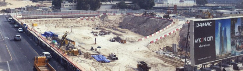
Track, map, survey, inspect, and manage your worksite projects with Falcon.3D. Construction site aerial imagery is the innovative solution to deliver sophisticated analytics or provide a visual progress report to stakeholders. We have experience in several construction sites and holds all the necessary insurance to perform the job safely and under compliance.
Falcon 3D aims to provide accurate and reliable Aerial Drone Surveying services in UAE to esteemed entities in the government and private sectors via aerial surveying for the purpose of land management & development, stockpile volumetric measurements, and land slope monitoring, mapping greenfield projects, designing smart cities, and much more.
By combining high-end surveying drones and a crew of skilled licensed pilots and expert engineers, our team uses drone mapping to conduct an aerial thermal inspection and generates highly accurate topographic maps of centimeter-level accuracy. We provide the below-mentioned deliverables to our clients to ensure they can practice more agile decision-making:
Orthomosaic Maps
We take the images captured on the drones, fix the image distortion and stitch them together to create a highly-accurate orthomosaic map for your analytical review. Every pixel shows 2D geo-information (X, Y) and can help derive accurate measurements of horizontal distances and surface areas.
3D Point Cloud
Using drone thermal inspection, we can generate a densified point cloud where each point contains geospatial (X, Y, Z) data and color information. It is most beneficial to derive an accurate model for slant and horizontal distance, surface area and volume measurements of various objects.
Digital Surface Models (DSM)
The images captured on drones are used to create DSM models of the surveyed area. These images are so accurate and detailed that every pixel shows 2D information (X, Y) and the altitude (Z ) for the highest point in the position.
Digital Terrain Model (DTM)
By filtering the various objects in the area, such as buildings, the images are used to create Digital Terrain Models (DTM). Each image pixel contains 2.5D information (X, Y, Z value of the highest point in the altitude).
Contour Maps
Using custom contour intervals of the DTM or DSM, we can create a contour lines map that can give you a better understanding of the surface area captured on the drone.
3D Textured Mesh
A 3D textured mesh is used to visually inspect the project progress by the stakeholders. It is essentially a replica of the edges, faces, vertices and texture of the area captured in the drone images.
Drones can be equipped with cameras, geo-location sensors, infrared sensors, and more to capture precise details about the environmental and physical site prior to and during construction. The high-resolution images captured by a drone are then turned into accurate 2D orthophotos and 3D models, creating a rich digital representation of your jobsite. Then, drone data platforms like 3DR Site Scan make it easy to overlay design files onto drone maps, enabling you to pinpoint constructability challenges in preconstruction, spot mistakes, and measure progress during construction.
We have a professional experts for drone thermal inspection, aerial thermal inspection, aerial drone surveying with higly specialist pilot companies in our industries.We are working with aerial survey pilot operators who can give you the best experience in all types of the drone related services with highly advanced digital imaging and laser scanning systems like drone inspections, drone survey, drone Arial mapping services in all the formats in a complex and high performance endorsements.
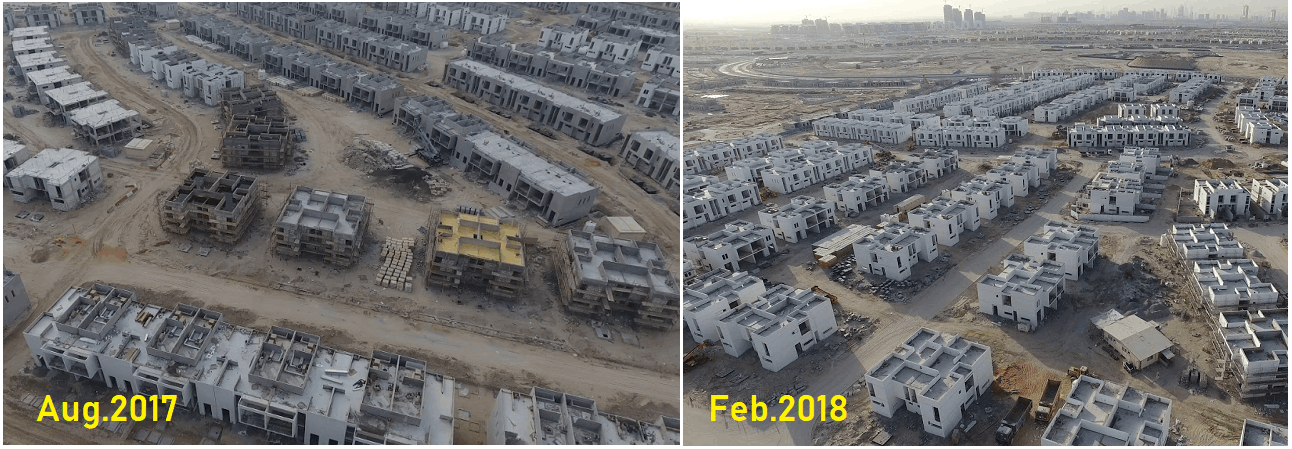
Owners and other stakeholders understandably demand progress updates on a regular basis. This can be a pain for you, if you have to walk the site or send someone to take photos. Drones can make this aspect of the job both a painless experience for you, and a better experience for them.
Drone imaging can provide instant ROI by providing rich data to share with project owners on a regular basis
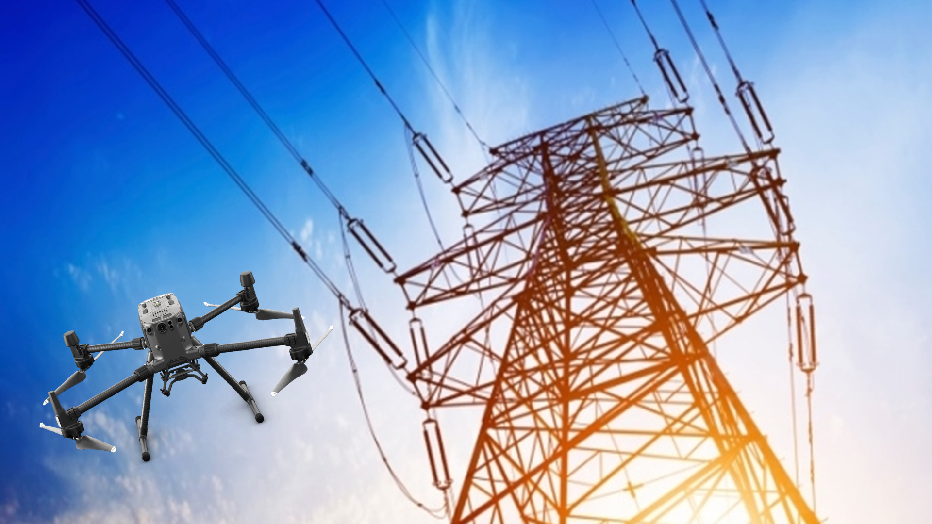
The leading cause of private sector worker fatalities on the construction site is falls, representing nearly 39% of all deaths. Drones can be used to keep workers’ feet planted firmly on the ground when they might otherwise have to climb to take manual measurements or engage in other activities that can be replaced with a drone.
When it comes to project updates, “drones can provide instant ROI,” of a Construction Projects. “Drones can be operated autonomously, on your own schedule.” Scheduling a regular flyover is simple and inexpensive, and provides rich data to share with project owners.
Contractors carry significant risk on every project. From being overbilled on one side, to being underpaid on the other, to mistakes, rework, missed deadlines, and legal challenges, few industries provide as many opportunities to lose money.
Data from drones can help mitigate many of these risks by identifying problems before they arise, providing accurate data regarding disputes, and documenting the process against legal challenges.
“For example”; “one of our customers used their drone data to help win a dispute with a subcontractor who was significantly overcharging them. By having accurate daily site documentation, our customer quickly resolved the dispute and saved over AED 100,000 without having to go to court.”
Once a vision of the future, drones are here now, and their use in construction industry is only going to grow.

Locate Us
Suite #209, Apricot Tower
Dubai Silicon Oasis
P.O. Box 238544, Dubai
United Arab Emirates
Call Us: +971 4 327 1414 (Dubai)
Call Us: +971 2 550 4300 (Abu Dhabi)
OUR SERVICES
LASER SCANNING SERVICES